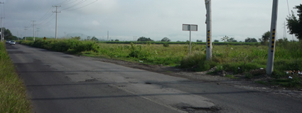
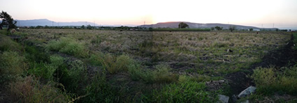
Terreno "La Curva", oportunidad de inversión en zona destinada al desarrollo urbano, turístico y comercial / investment opportunity in an area designated for tourist, urban and commercial development.

"La Curva"

Ground plane on board the main artery road between
Jojutla and Zacatepec, Morelos.

Area: 11.609 acres
with a front of 251.62 yards.
(writing public)

"La Curva"

Terreno plano a bordo de la principal arteria carretera entre Jojutla y Zacatepec, Morelos.

Superficie: 47,000 m2
230 metros de frente.
(escritura pública)

¡¡ EN VENTA O RENTA !!
¡¡ FOR SALE OR RENT !!
 
Descargar el ENLACE para visitar la propiedad
(necesita tener instalado el programa gratuito "google earth")
Si ya cuenta con el programa también puede ingresar la siguiente ubicación en volar a: 18.6318390546,-99.1854551868

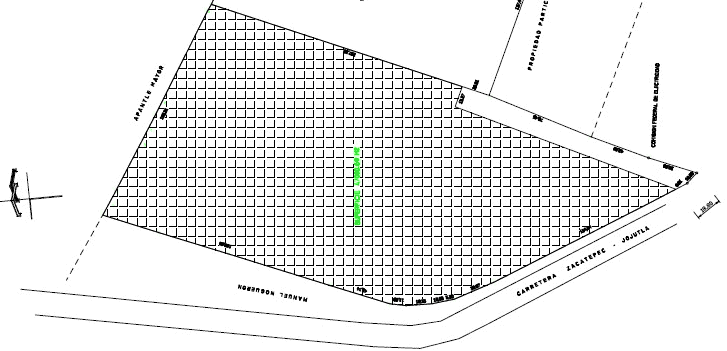
Plano del Terreno
plano de la curva
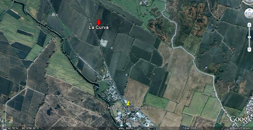
Plano de la Ciudad de Jojutla, Morelos. En donde se encuentra ubicado el terreno "La curva"
Controles de visualización:

Ver mapa más grande  
Más información de Jojutla:

JOJUTLA

Ubicación

• Latitud 18'36' N N
• Longitud 099'11' W O
• Altitud 890 msnm

Jojutla es un municipio perteneciente al estado mexicano de Morelos, colinda al norte con los municipios de Zacatepec de Hidalgo, al este con Tlaltizapán, al oeste y sur con Tlaquiltenango y al oeste con el de Puente de Ixtla. Tiene una superficie territorial de 142,633 kilómetros cuadrados que representan el 3.2 % de la superficie del estado. Tiene relieve ligeramente accidentado y desarrollo agropecuario medio, en agricultura cuenta con cultivos de caña, arroz -uno de los mejores del país-, fríjol, etc., también se extrae grava y arena de las canteras del municipio. Pertenece al 11° Distrito electoral local y al 4° Distrito electoral federal.

Su nombre proviene del náhuatl "Xoxutla" , "Xoxu" hace referencia al "color azul del cielo" y "tla" de tlalti que significa "diente" que se usaba para indicar abundancia , la palabra se completa traduce como "lugar donde abunda el color azul del cielo"

Clima

El clima de este municipio es cálido la mayor parte del año, pueden registrarse temperaturas por encima de los 30°C los meses de abril, mayo y junio, siendo de 27°C en promedio, en noviembre, diciembre y enero se registran las temperaturas más bajas que no bajan de lo 18°C.

La temporada de lluvia regularmente inicia en junio y se prolonga hasta septiembre que promedian 917 mm al año.

Cráter Marciano

En Octubre del 2007 La Unión Astronómica Internacional aprobó dar el nombre de Jojutla a un cráter del planeta Marte. Este crater está localizado cerca del polo norte marciano (lat.Norte 81.5 y lon 169.6) y tiene un diámetro de 19 kilómetros. La propuesta fue hecha por el divulgador científico Mexicano, Andres Eloy Martinez Rojas, quien en el año 2003 envió tal petición a la Unión Astronómica Internacional. El nombre fue aprobado en la misma asamblea en la que fue degradado Plutón como planeta

http://es.wikipedia.org/wiki/Jojutla

JOJUTLA

Location

• latitude 18'36 'N N
• longitude 099'11 'W O
• Altitude 890 m.

Jojutla is a municipality belonging to the Mexican state of Morelos, adjacent to the north by the municipalities of Zacatepec Hidalgo, at the east with Tlaltizapán, west and south with Tlaquiltenango, and west with Puente de Ixtla. It has a land area of 142.633 square kilometers representing 3.2% of the state. Has highlighted slightly injured half and agricultural development, agricultural crops with sugar cane, rice -one of the best in the country- , beans, etc.., It is extracted sand and gravel from quarries in the municipality.

Its name comes from the Nahuatl "Xoxutla", "Xoxu" refers to the "Blue Sky" and "tla" in tlalti which means "tooth" that was used to indicate abundance, the word is completed translates as "place of abundant blue sky "

Weather

The climate of this region is hot most of the year, can register temperatures above 30 ° C in April, May and June, reaching 27 ° C on average, in November, December and January temperatures were recorded not fall lower than the 18 ° C.

The regular rainy season starts in June and lasts until September, which averaged 917 mm per year.

Martian Crater

In October 2007 The International Astronomical Union approved the name of Jojutla to one crater on the planet Mars. This crater is located near the Martian north pole (lat.Norte 81.5 lon and 169.6) and has a diameter of 19 kilometers. The proposal was made by the Mexican scientific populariser, Andres Eloy Martinez Rojas, who in 2003 sent the request to the International Astronomical Union. The name was approved at the same meeting in which Pluto was demoted as a planet.